Bear Creek, not for the weak or inattentive
 About 100 miles south of Grand Junction, the town of Ouray is nestled in the San Juan mountains. Ouray is the small flat spot with stuctures in the center of the picture. The sign says "Little Switzerland" and having seen both, I agree, except the good thing is that it doesn't have the trams or trains or ski resorts of Switzerland. Ouray is mostly wild and unfiltered.
Ouray is surrounded by multiple peaks above treeline. You crank your eyes upward toward the peaks as you drive in to town and majestic music plays in your head, at least my head. Luckily, someone else was driving, so we didn't drive off the road. 2 miles south of Ouray is the trailhead for the hike up to Yellowjacket mine, on the Bear Creek trail. A good description can be found at:
http://www.ouraytrails.org/trails.html#bearcreek

This website says: "Not recommended as a first hike for people just getting up to this altitude, for those fearing steep dropoffs, or for those with venturesome children." Good advice. I'll illustrate the advice with this picture of the trail. Colorado gold miners pickaxed a narrow path along the face of granite cliffs so they could bring their stuff to the gold mines in this canyon. This brings up the obvious question, who is crazier, miners with gold fever who hiked this path, or the recreational hikers who do it for fun? One more piece of advice. Go early in the morning on a rainless day, it usually rains in the afternoon, and you don't want to be caught on this trail in the rain, as I was (wet slickrock and talus shale).
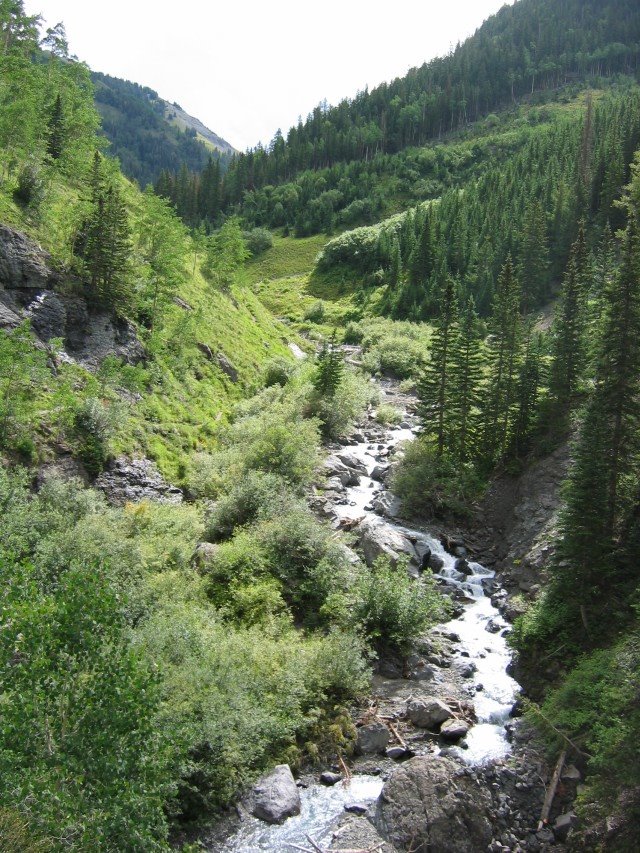
Sometimes the trail is close to Bear Creek and you see visions of rocky mountain spring water. By the way, this trail is on the other side of the continental divide from Coors, so this water never makes it into their beer.

And sometimes the trail is hundreds of feet above Bear Creek. I should have included my toes in this picture to give some idea of the depth of the canyon.
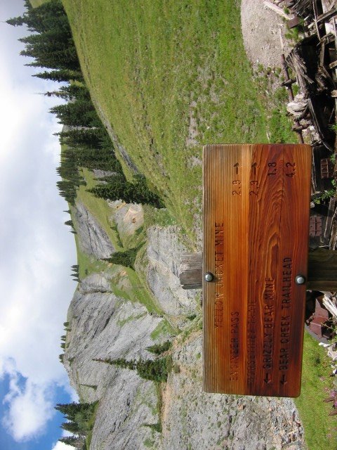
This picture posts sideways for reasons unknown to me. It is a picture of the sign at the Yellowjacket mine. I posted a question to the Blogger folks and maybe they can help me. You can see a faint hint of treeline up above and some iron mining junk at the base of the sign.
The trailhead south of Ouray is at 8400 feet. Yellowjacket mine is at 11,100 feet, just below treeline, and a climb of 2700 feet. I carried a light pack with just water, snacks, and a poncho, which I needed for the rainstorm on the way down. I have done some previous hikes, and my legs hurt on the way up, on the way down, and after the hike. When I mentioned my pain to the 60 year old woman who accompanied me on this hike (she wanted to go hiking again in a few days) she called me a "wuss". Hey! That's MISTER Wuss to you, pal :-)
posted by jobchange @ 2:18 PM
![]()
![]()

2 Comments:
At 3:59 PM, Nick said…
Came across your blog by clicking on next blog! Just want to say that you have some great pics and to keep up the good work! Love reading about different hikes and having never been to Colorado I am very impressed by the scenery!
At 5:10 PM, jobchange said…
I didn't think anyone read this, except my family. Thanks very much.
Post a Comment
<< Home